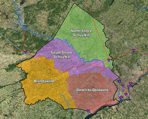
 The Chester, Delaware, and Montgomery Counties Regional Watershed Improvement Project is a collaboration of the U.S. Army Corps of Engineers (Philadelphia District) and the Pennsylvania Department of Environmental Protection (PADEP). This project, as part of the Southeastern Pennsylvania Environmental Improvement Program (Section 566 Program), has design-build authority to develop, design, and construct watershed improvement projects related to flooding, water quality, and environmental restoration within the project area. All phases of this project are cost-shared 75% Federal / 25% Local and are funded through Congressional appropriations.
The project is a collaborative partnership with local entities to improve regional coordination and collaboration and to facilitate the accelerated implementation of beneficial watershed improvement projects inside the project area. The project is structured to focus on regional, integrated solutions which best address multiple priority watershed issues.
Initial steps include the assessment of existing conditions and the objective identification of priority areas for watershed improvements. Priority areas identified may move into subsequent phases, including project alternatives development, preliminary design, final design & permitting and ultimately construction.
The Decision Support Tool (DST) was developed to provide an objective assessment of existing conditions consistently over the 1000 square mile project area and to identify and prioritize areas in greatest need of watershed improvements. To facilitate both initial ease of use and continued use by stakeholders, the DST was developed as an ArcGIS 10 Extension. The DST and all input data are available for download here on the project website. The accompanying Prioritization Report and DST User Manual are also available in the box to the right.